For me (Luis), one of the main challenges I face when walking in Asturias is following the intended path as the way-marking on some of the walks isn't very clear. Frequently the way-marks can be difficult to spot when they comprise of a fading yellow dot painted on the rock or a pile of limestone that can easily be missed.
To compound this situation, I need to add in to the equation my poor sense of direction. Normally I am dependent on others to go out and enjoy the numerous maintain walks off the beaten path within the Picos de Europa National Park. Having said that, I have started looking at maps closely so that I can build up some confidence in my map reading skills that will allow me to venture further into the mountains and thus discover some remote areas while occasionally enjoy the solitude of a solo walk.
I recently ventured out on a beautiful 9 hours walk, my first solo walk along part of a well known route that crosses the length of the National Park, The Reconquest Walk. This is a very long walk that normally comprises two ten hour walks with an overnight stay in one of the mountain refuges; for those who want to walk its entire length.
My walk started in an area I am familiar with and I had previously seen the path in the distance while on a walk with someone else who was in charge of navigation.
Having told Ian of my intended route and the latest time by which I was planning to return home, my main safety consideration was to ensure that I would always find my way back to where the car was before venturing further up into the mountains or across the valley before me.
The Reconquest path starts at the church of Covadonga where history tells us how the first king of Asturias, Pelayo, was told in a dream by the virgin Mary where to hide before defeating the Moors in a big battle and thus starting to reconquer the Iberian peninsula from several centuries of Muslim rule.
After driving up to Lake Ercina, one of the mountain lakes within the park, I walked familiar territory to Belbin, alpine pasture land where I would join the Reconquest path on the way towards the Cares Gorge.
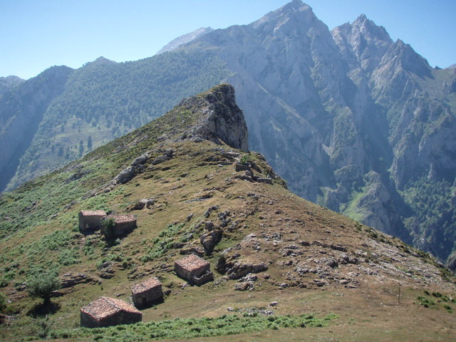
After several hours enjoying my walk in solitude across dramatic landscapes that took me across meadows, wide valleys and steep hills, I reached an area known as Oston where shepherds spend the Summer months tending their livestock and making cheese.
 |
On the return I could not resist the tranquillity and beauty within the Belbin pastures and thus stopped for a while to take in the views and celebrate finding my path without getting lost other than for the 30 minutes detour I took by mistake. As a result I ended conquering an additional small hill which I did not really mind as I had an opportunity to admire lots of butterflies feeding on the alpine Eryngiums (Sea Holly) that were in full bloom at this time of the year. I wonder where my sense of adventure will take me next?


Thanks Rob - The Cares Gorge is truly stunning. Sadly I cannot open your link without registering for it.
ReplyDelete